
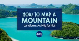
Learn how to make a 3D topographic map with your students using clay and dental floss! This topographic map landforms activity for kids is a great way for students to gain experience building models and the perfect opportunity to add math and map skills to your Landforms & Earth Changes science unit.
What is a topographic map?
Maps are a type of model—they are copies of something real. Maps help us learn about an object or a location.
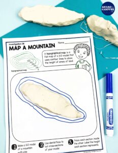
A topographical map is similar to a physical map. It shows the differences in elevation changes in landscape using contour lines. It is basically a one-dimensional model that shows heights using numbers and curved lines.
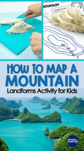
In this 3D topographic map activity, students will use clay to make a 3D model, then section it with dental floss to make a topographic map. Students begin by making a simple model of a mountain out of clay. Then, they use dental floss to section their model into equal slices.
Topographic Map Landforms Activity
This video, Understanding Topographical Maps, is a great resource for demonstrating how to use clay and dental floss to make a topographic map.
Introduce the investigation by asking students: How can you map the height of a mountain?
How to make a 3D topographic map
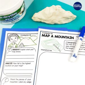
Materials:
- chunk of Crayola Air-Dry Clay (about the size of a lemon)
- approx. 12 inches of dental floss
- lab sheet
- marker
Procedure:
1. Pass out clay, dental floss, and lab sheets to students.
2. Students will make a mountain with a flat bottom out of their clay.
3. Ask students to visualize where they can make 4 equal cuts in their clay mountain.
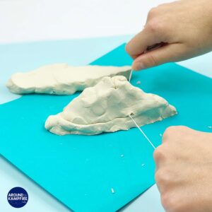
4. Using the dental floss, students start at the bottom and cut the first cross-section of their mountain.
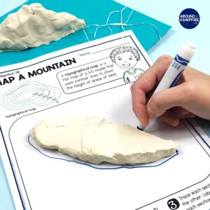
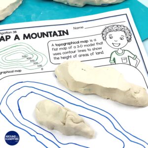
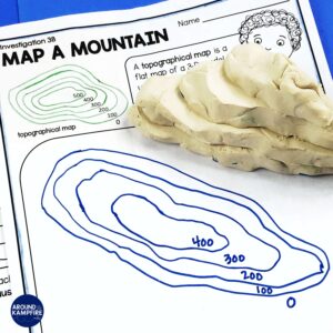
5. Students lay the bottom slice on their lab sheet and trace around it with a marker to create the first contour line.
6. Students use the dental floss to continue to make equal-sized, cross-section cuts starting at the bottom of the model and working upward.
Place the cut section in the middle of the previously traced line and trace the bottom of each section. Repeat until all sections have been cut and traced.
7. Add a scale by labeling the contour lines on their drawings. For simplicity, we will say that each section represents 100 feet.
8. Students answer the questions on the back of the lab sheet by explaining what their map shows, what the lines represent, and comparing the highest and lowest locations on their maps.
More landform activities and lessons
This map a mountain landforms activity and the lab sheet is part of a complete NGSS Landforms & Earth Changes unit for 2nd grade that is also available in a digital format with narrated audio science lessons.
Click here to see the yearlong 2nd grade science series.
Making this 3D topographic map is a fun way to incorporate both map skills AND math practices as you teach science. It’s a great activity for deepening students’ understanding of map concepts. Make sure to pin this post so you have it when you plan!
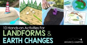
Find more hands-on landforms and Earth changes activities and teaching ideas in this post:
Happy teaching!


Hi, I wanted to see if I could purchase just this resource without the bundle.
Hi Anna,
Thanks for reaching out! Unfortunately I don’t have the lab activities available separately from the unit.